Chinaʼs new official map of the country can only increase Indiaʼs suspicions about its intentions. While strategists ponder whether India will react to this provocation, it may be more realistic to examine Indiaʼs options if the Modi Government does decide to retaliate and how it can still hope to obtain financial investment from China.
Background
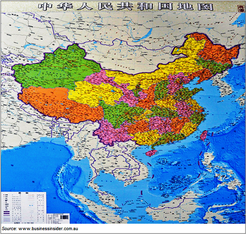
China recently released a new official map of the country. Previous official maps included Chinaʼs claims in the South China Sea in a little box, reducing the holistic impact of the new one. While it is interesting that the “nine dash line” – Chinaʼs delineation of its maritime boundary in the South China Sea – in that region has been increased to ten dashes, the inclusion of its eastern state of Arunachal Pradesh as South Tibet in the map has caused ruffled feathers in New Delhi. A Ministry of External Affairs spokesman retorted that Arunachal Pradesh remains ʻan integral and inalienableʼ part of India, and ʻcartographic depiction does not change facts.ʼ That, however, may not be the end of the matter.
Comment
Arunachal Pradesh is claimed by China as a part of South Tibet, a claim India disputes. Both the Ministry of External Affairs and the Chief Minister of Arunachal Pradesh, Nabam Tuki, have protested the depiction of Arunachal Pradesh as part of China. The Chief Minister said, ʻWhat China has done is not a new thing. We object to and condemn their claim on Arunachal Pradeshʼ. He demanded that the Indian Prime Minister, Narendra Modi, intervene.
Mr Tuki and India have reason to be aggrieved. Apart from laying claim to the Indian state, China has previously refused to stamp the passports of Indian citizens from there who wished to travel to China, instead stapling visas to their passports. By this act, they sought to demonstrate that China considered these people Chinese and not Indian.
In 2010, China denied a visa to the then Northern Army Commander, Lieutenant General B.S. Jaswal, to demonstrate that the state of Kashmir was disputed territory. India retaliated by cancelling both his visit to China and military exchanges. In 2012, India cancelled another military delegation to China after it refused to give Indian Air Force Group Captain M. Panging a visa. Besides being an Indian citizen from Arunachal Pradesh, Panging was the Chief Operations Officer at the Tezpur air base in that state. In April this year, Chinese officials orally demanded that those Indians from Arunachal Pradesh who were part of a youth delegation to China be excluded from it. India once again mulled over cancelling the visit altogether.
It is noteworthy that the publication of this map comes at a time when Indian Vice President Hamid Ansari is in Beijing to celebrate sixty years since the signing of the Panchsheel (Five Principles) Agreement by the two countries and Burma/Myanmar. Indian officials said the issue of the map could be raised by Mr Ansari in Beijing. Meeting with Mr Ansari and Burmese President Thein Sein, however, Chinese President Xi claimed that China remained true to the agreement and its principles of peaceful co-existence, mutual non-aggression, territorial integrity and sovereignty, and non-interference in internal matters.
These platitudes notwithstanding, the Modi Government is likely to take a strong stand against any claims to Indian territory. After Mr Modiʼs speech about Indiaʼs sovereignty in Arunachal Pradesh in the run-up to the recent election in which he effectively said that Arunachal Pradesh is, and would remain, Indian territory, it is likely he will have no option but to do so. His government could revisit a precedent from 2007, when the then Chinese Ambassador to India, Sun Yuxi, stated in a television interview that all of Arunachal Pradesh belonged to China. Indiaʼs response was to invite to New Delhi Ma Ying-Jeou, then Taiwanese opposition leader and presidential candidate of the Chinese Nationalist Party, the KMT, all the while denying that his visit had anything to do with the ongoing dispute.
Again, the Indian Government could consider a tit-for-tat rejoinder, publishing maps showing an independent Tibet. This would irritate Beijing in the same way as Indiaʼs joint statement with the Philippines in October 2013, which called the South China Sea the West Philippines Sea, as Manila refers to the disputed sea. That statement contradicted Indiaʼs policy until then of calling the area the South China Sea, so as to avoid upsetting Beijing.
On the other hand, the Modi Government must bear in mind that it is close to signing an agreement with China to establish industrial parks in India, while also addressing its China trade deficit of around US$40 billion. The details of this agreement will be announced by the Indian Minister of State for Commerce, Nirmala Sitharaman, and the Chinese Minister for Commerce. Also, the Foreign Secretary, Sujatha Singh, recently announced that India is seeking infrastructure investment by China to the value of a staggering US$1 trillion.
Mr Modi will have to call upon all his diplomacy and balancing skills to achieve an acknowledgement of Indiaʼs territorial sovereignty by China and simultaneously obtain the financial investments and commercial concessions that he seeks from it.
Lindsay Hughes is a research analyst at the Indian Ocean Research Programme. She can be contacted at lhughes@futuredirections.org.au.
This article was originally published by Future Directions International. It is republished with permission.